Accurate • Reliable • Local
Professional land surveying and drone mapping across South East Queensland.
From feature & contour surveys to engineering setout, we deliver precise data you can build on.
Feature and Contour Surveys
also known as Detail Survey, Topographic Survey or Site Levels Survey
A Feature and Contour Survey provides a comprehensive and accurate plan of your property’s existing conditions. We capture all visible natural and built features, including ground levels, contours, trees, fences, buildings, retaining walls, services, driveways, adjoining property details, and more.
This information is essential for planning, engineering, architectural design, and council approvals, giving you confidence from concept to construction
Ideal for
- Subdivisions
- Accurate site data to support boundary design, lot layouts, and approvals.
- Extensions
- Clear site levels and features to ensure seamless integration with existing structures.
- New homes
- Precise ground information to support design, drainage, and construction planning.
- Swimming pools
- Detailed site levels to assist with design, excavation, and compliance.
- council DA submissions
- Professional survey plans prepared to meet local authority requirements.

Drone Imagery
High-resolution aerial photography and orthomosaic maps captured with professional survey-grade drones. We deliver sharp, geo-referenced overhead images, 2D plans, 3D models, and volume calculations where needed. Drone imagery gives your project team a powerful visual overview that is difficult to achieve with ground-based methods alone.
Ideal for
- Site planning
- Up-to-date aerial site views to assist with layout design, access planning, and coordination.
- Progress monitoring
- Regular aerial captures to track construction progress and document key project milestones.
- Marketing presentations
- High-quality aerial visuals for reports, proposals, and client-facing presentations.
- Large scale detail surveys
- Efficient capture of expansive areas where traditional ground surveys are time-consuming.
- Volume reporting
- Accurate stockpile, cut and fill, and earthworks volume calculations from aerial data.

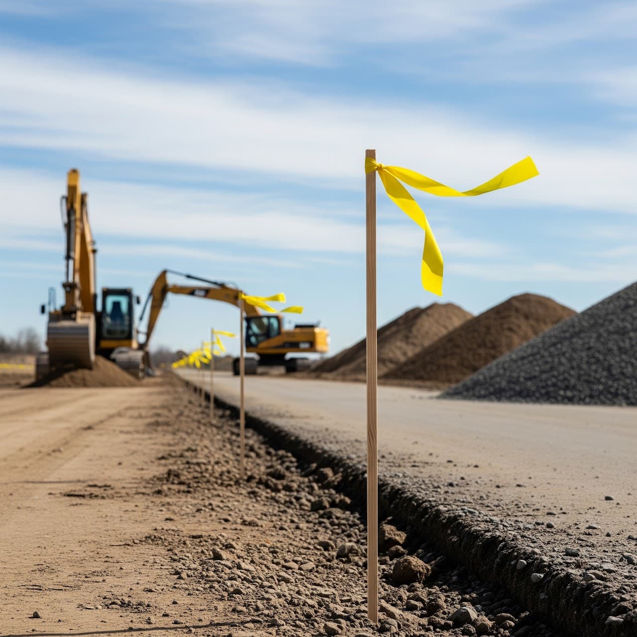
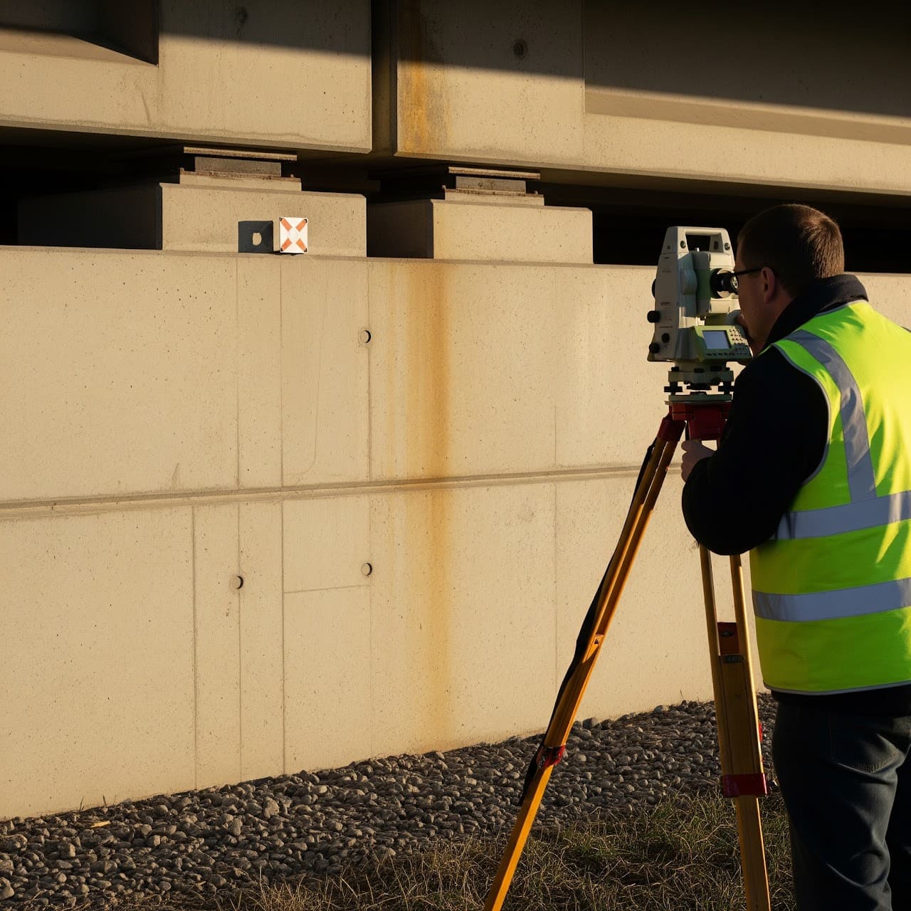
Engineering Survey
Engineering Surveying delivers high-precision data for projects where accuracy is critical. We provide reliable survey solutions to support construction, monitoring, and compliance at every stage of a project. All work is carried out to Australian standards, delivering results engineers, contractors, and certifiers can trust.
Our Engineering Survey services include
- Construction set-out
- Precise positioning of design elements on site to ensure construction is built in the correct location and levels.
- As-built surveys
- Verification surveys to record completed works and confirm they have been constructed to design specifications.
- Monitoring surveys
- Ongoing measurement of settlement, deformation, and structural movement to manage risk and ensure compliance.
- Site control establishment
- Creation of reliable control networks to provide a precise reference framework for all construction works.
- Volumetric surveys
- Measurement of stockpiles, earthworks, and cut/fill volumes for reporting, payments, and project tracking.
- Precise levelling & alignment
- High-accuracy level and alignment surveys for infrastructure, slabs, pavements, and structural works.
Site Setout
We accurately transfer your approved design plans onto the ground, ensuring every structure is positioned and levelled exactly as intended. From house footings and retaining walls to roads and drainage. This gives you confidence that your project is built in the right place.
- Reduce rework and delays
- Accurate setout prevents costly mistakes before construction begins.
- Plan compliance
- Ensures all works are built exactly to approved design drawings.
- Improved site efficiency
- Clear positioning helps trades work faster and more accurately.
- Fewer construction errors
- Minimises issues before concrete pours and structural works.
- Peace of mind
- Confidence for builders, engineers, and certifiers throughout the project.